Description
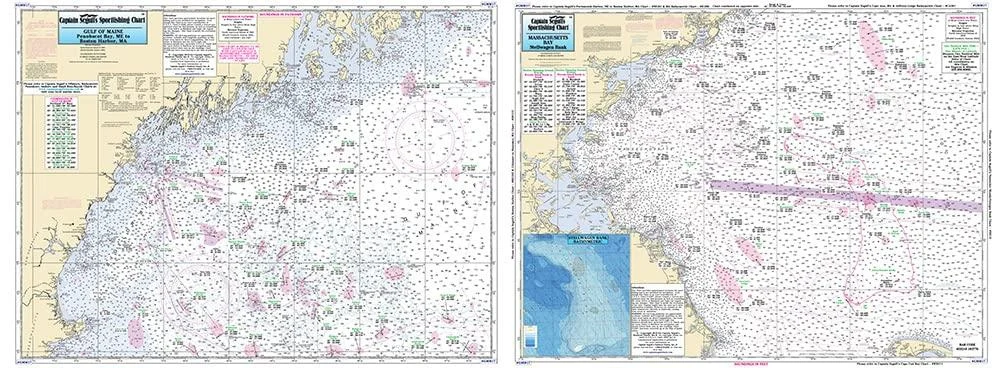
Offshore Fishing Chart: Side A, the Gulf of Maine from Penobscot Bay to Boston, Massachusetts Bay. Side B, Massachusetts Bay, Boston south to Provincetown and Duxbury, MA includes a bathymetric inset of Stellwagen Bank Double sided laminated fishing Chart. Shows fishing areas, wrecks, reefs, local names and amenities in GPS out to the thousandths of a minute. 19.5″ x 26.5″
Laminated Fishing Chart.
Date First Available: February 27, 2016. Best Sellers Rank: #415,170 in Sports & Outdoors. Customer Reviews: 3.7 out of 5 stars6 ratings3.7 out of 5 stars. : B01CB48ZZY. Size: ?19.5″ x 26.5″. Part Number: ?GMM17. Manufacturer: ?Captain Segull’s Nautical Charts, Inc. Color: ?waterproof laminated. Brand Name: ?Captain Segull’s Sportfishing Chart. Package Weight: ?0.25 Kilograms. Item Package Dimensions L x W x H: ?20 x 1.6 x 1.5 inches.
Reviews
There are no reviews yet.