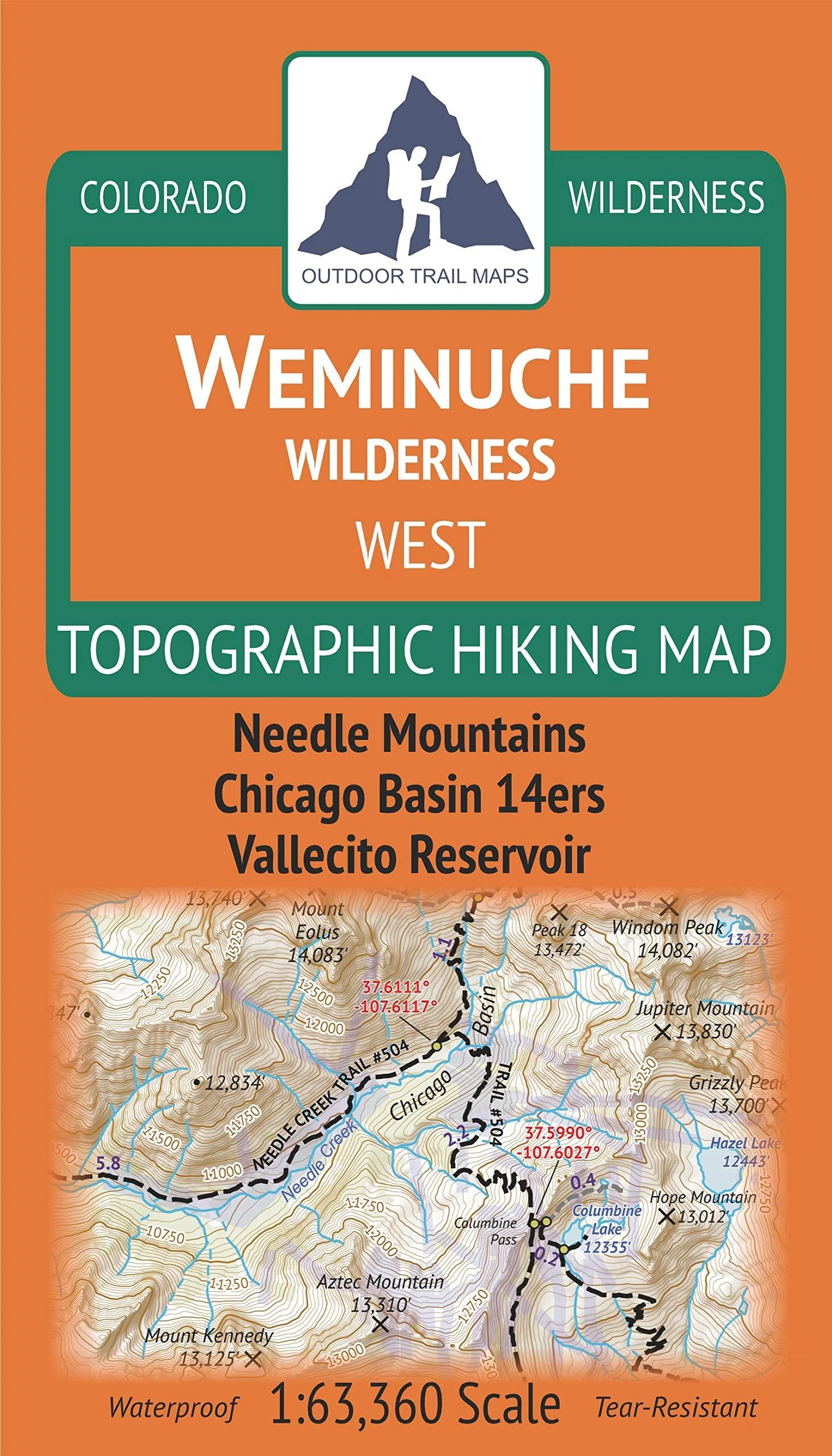
Description
Waterproof, tear-resistant topographic hiking map covering all of the hiking trails in the western portion of the Weminuche Wilderness of southwest Colorado near Durango and Silverton. This includes the Needle Mountains and West Needle Mountains of the greater San Juan Mountains. This map shows the two wilderness trailheads of the Durango and Silverton Narrow Gauge Railroad including the Needleton stop leading into Chicago B where four 14ers can be found: Windom, Eolus, North Eolus and Sunlight. The front side of the map covers the area from Vallecito Reservoir up to Chicago B, while the back of the map shows the trails from Chicago B north to Silverton. See separate Weminuche Wilderness EAST Map by Outdoor Trail Maps LLC for coverage of the eastern portion of the wilderness.
GPS coordinates for trailheads and trail junctions – device compatible. Up-to-date for 2019 with accurate trail routings and distances. Segment distances – mileage – for all trails. Smaller and lighter – no more unfurling huge maps – designed for on-trail use. Waterproof, tear-resistant, 1:63,360 scale with a compact 4″x7″ folded size for your pocket.
Paper Finish: Coated. Map Type: Trail, Topographic. Brand: Outdoor Trail Maps. Date First Available: April 12, 2019. Best Sellers Rank: #403,296 in Sports & Outdoors. Customer Reviews: 4.9 out of 5 stars11 ratings4.9 out of 5 stars. : 1946906514. Part Number: ?9781946906519. Manufacturer: ?Outdoor Trail Maps LLC. Brand Name: ?Outdoor Trail Maps. Package Weight: ?0.04 Kilograms. Item Package Dimensions L x W x H: ?6.85 x 3.98 x 0.28 inches.
Reviews
There are no reviews yet.