Description
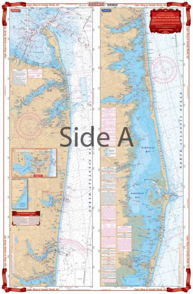
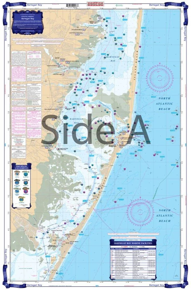
Complete inside coverage for the New Jersey Shore from Cape May and the Cape May Canal north through Avalon and Ocean City, including Atlantic City, through Great Bay and Little Egg Harbor on the south side. The north panel covers all of Barnegat Bay and Toms River, through the Point Pleasant canal and the Manasquan River. Also covers the Shark River, the Shrewsbury River, the Navesink River and Red Bank and Sandy Hook Bay and Atlantic Highlands. Details are provided for the Shark River, Manasquan Inlet, and Atlantic City. A colored key on each side and large print place names make areas very easy to find. A total of 14 GPS WAYPOINTS are pre-plotted. Information from 2 NOAA charts; #12324 & #12316. Chart is 25″ X 38″. WGS84 – World Mercator Datum. Easy-to-Read Large Print Waterproof Paper Tear resistant Paper (Indescribable) Printed on two sides – 2 charts in 1: Larger Area of Coverage Charts are Compiled From Several NOAA Charts & Local Information
A total of 14 GPS WAYPOINTS are pre-plotted. Information from 2 NOAA charts. A colored key on each side and large print place names make areas very easy to find. Also covers the Shark River, the Shrewsbury River, the Navesink River and Red Bank and Sandy Hook Bay and Atlantic Highlands. Details are provided for the Shark River, Manasquan Inlet, and Atlantic City. The north panel covers all of Barnegat Bay and Toms River, through the Point Pleasant canal and the Manasquan River. Complete inside coverage for the New Jersey Shore from Cape May and the Cape May Canal north through Avalon and Ocean City, including Atlantic City, through Great Bay and Little Egg Harbor on the south side.
Shape: Rectangular. Brand: Waterproof Charts. Frame Type: Unframed. Product Dimensions: 38″L x 25″W. Material: Polypropylene. Date First Available: October 1, 2001. Best Sellers Rank: #977,610 in Sports & Outdoors. Customer Reviews: 3.9 out of 5 stars6 ratings3.9 out of 5 stars. : B001447158. Part Number: ?56. Manufacturer: ?Waterproof Charts. Brand Name: ?Waterproof Charts. Item DimensionsLxWxH: ?38 x 25 x 0.01 inches. Package Weight: ?0.23 Kilograms. Item Package Dimensions L x W x H: ?20 x 15 x 0.05 inches. Mounting Type: ?Wall Mount. Orientation: ?Portrait. Shape: ?Rectangular. Brand: ?Waterproof Charts. Frame Type: ?Unframed. Product Dimensions: ?38″L x 25″W. Material: ?Polypropylene.
Reviews
There are no reviews yet.